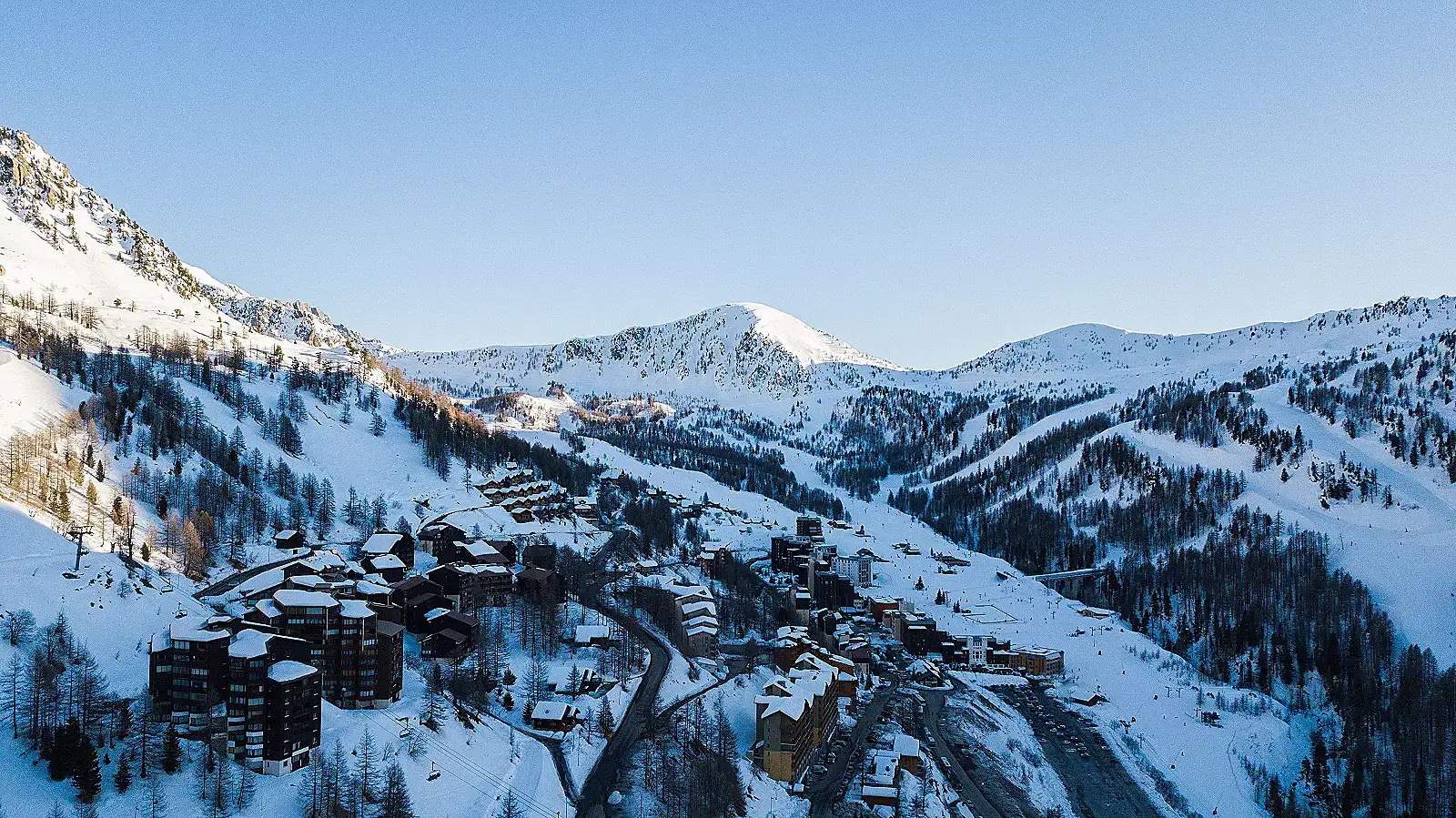
Sestriere ist ein alpines Skigebiet in Italien. Sestriere liegt auf einer Basishöhe von 2035 m. Die veröffentlichten Zahlen umfassen 400 km Pisten und 70 Lifte.
Typischerweise Anfang Dezember bis Mitte/Ende April. Ein Drittanbieter-Buchungsportal (esquiades.com) gibt für die Saison 2025-26 den Zeitraum 6. Dezember 2025 bis 19. April 2026 an; dies ließ sich nicht unabhängig direkt bei vialattea.it bestätigen (siehe Hinweis zur Datenqualität unten). Nächstgelegener Bahnhof: Oulx (Oulx-Cesana-Claviere-Sestriere), ca. 20 km, mit ca. 30 Min. Anschlussbus nach Sestriere. Nächstgelegener Flughafen: Turin Caselle (TRN), ca. 90 km, ca. 1,5 Std. mit dem Auto.
Gondelbahnen und Sessellifte sind oben unter „Wichtige Lifte" aufgeführt. Hier sind ausschließlich Pendelbahnen mit zwei Stationen aufgeführt — ein eigener Anlagentyp.
Nur verifizierte Standorte: das Skigebiet selbst und seine Seilbahnstationen. Für einzelne Unterkünfte liegen uns keine genauen Koordinaten vor, sie werden daher hier nicht angezeigt — nutzen Sie den Buchungslink in der Seitenleiste.
Ski schools
Terrain park (freestyle park with slopestyle and jibbing lines, plus a beginner area)
Night skiing (floodlit piste, Kandahar/Sises Gianni Agnelli run)
Outdoor ice rink (skating, curling, ice hockey)
Jeder Hinweis unten stammt aus einer offiziellen Veröffentlichung des Skigebiets oder einer unabhängigen Quelle.
DATA QUALITY CAVEAT: vialattea.it (the official Via Lattea ski-lift consortium site, the most authoritative source for this resort) blocked automated fetch access (HTTP 403 from both a direct fetch tool and a plain curl request) during this research. Facts attributed to vialattea.it below are corroborated only via search-engine snippets/cached text and via the officially affiliated Comune di Sestriere tourism site (sestriere.it), not a direct read of vialattea.it pages. Treat Sestriere's entries as the thinnest-verified of the four resorts in this set.
Summit altitude left null: secondary sources disagree meaningfully on the ski area's highest lift-served point — Monte Motta is cited variously as 2,800 m, 2,823 m, or 2,840 m, and Monte/Cima Fraiteve as ~2,700-2,701 m — with no single figure confirmed on an official page we could directly read. Do not treat any one of these as authoritative.
sestriere.it (official) publishes a RUN-COUNT breakdown for the whole Via Lattea network — 7 green, 80 blue, 120 red, 42 black runs, out of 249 runs total — but this is a count of runs, not kilometres, so it was not used to populate the piste_km_green/blue/red/black fields (left null). A separate, unofficial (non-vialattea.it) source quoted a *possible* km-based split of roughly 96 km beginner / 220 km intermediate / 84 km expert for the 400 km network, but this could not be traced to an official publication and was deliberately excluded.
All piste/lift figures reported are for the whole Via Lattea network, not Sestriere alone — flagged prominently per the task's Dolomites/Italian-ski-marketing ambiguity warning (the same single-resort-vs-network ambiguity common in the Dolomites also applies here, just for a Piedmont network rather than Dolomiti Superski).
Sestriere sits within the larger Via Lattea (Milky Way) ski area; lifts listed here are limited to those physically at/serving Sestriere itself, not the connected villages (Sauze d'Oulx, San Sicario, Claviere, Montgenèvre).
Lift type/capacity/year data drawn mainly from the skiresort.com/skiresort.info aggregator family — treat as one data lineage rather than fully independent cross-verification of exact figures.
Terrain park and night-skiing details are corroborated across multiple general ski-guide sources but not directly confirmed on vialattea.it's own site during this research pass.
 ResortSlopes